Pages

Sunday, October 26, 2014

Mississippi Sound


By Capt. Scott

The Mississippi Sound is part of the southern Gulf states inland waterway however it is an expanse of open water that is dotted with barrier islands and shallow water.  It has a 110 mile long fetch to the east and west and the wind are predominately out of the east at this time of the year (Oct).  I had been dreading this part of the passage the most.  If the winds were out of the east with any intensity I knew this would be one very long slog into the wind with no protection, few places to hide and little chance to sail.  I was not disappointed.
image
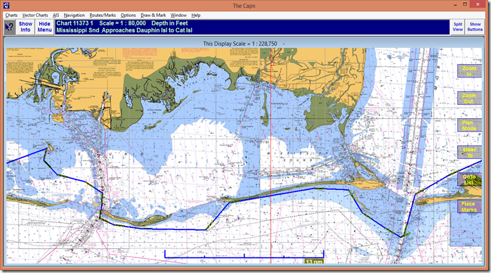
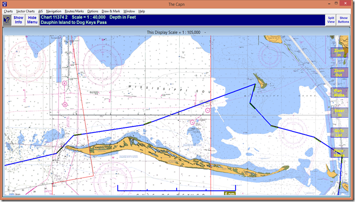
The above picture shows our route thru the Mississippi Sound and across Mobile Bay.

The Route

We left Rabbit Island LA in the wee hours (over on the left of the picture above) with a plan to get as far as either Ship Island or Horn Island and find an anchorage,  Once we were into the sound the winds were building out of the ENE and NE.  The waves were from dead ahead and slowed the boats speed to 4.2 knots and sometimes down to 3 knots when a series of tall waves pounded the bow.  With this slow speed I had two options, one to increase the engine power which means I will be burning a lot of fuel and get even more pounding or except that at this speed I will not make it to even Ship Island and may have to find and anchorage on Cat Island. 

A Different Route

I told the 1st mate I was thinking about ducting south of Cat Island to try and use the Island as a breakwater and try to get better speed.  This meant sailing on the Gulf of Mexico side of the Island where I might encounter some of the Gulf swell.  The 1st mate pointed out Cat Island pass on the Chart and I told her I would advise taking some sea sickness medicine before we make the turn. She did and I made the turn. 

Going South. 

The turn south in conjunction with a NE wind meant we could sail a bit and out went the Jib.  Boat speed increased to 5.7 knots and once we got out behind the Island and out of the choppy waves the speed increased to 6.5 knots.  Once we rounded Cat Island there is an open section between Cat Island and Ship Island.  Once again were were in the slop except there was the Gulf swell added so that every minute or so you would hit some really big waves that would nearly stop the boat in its tracks.  I decided to stay south of Ship Island and Little Ship Island as well.  Our speed was averaging 5.5 knots which while it is not great would do. 

The Horn

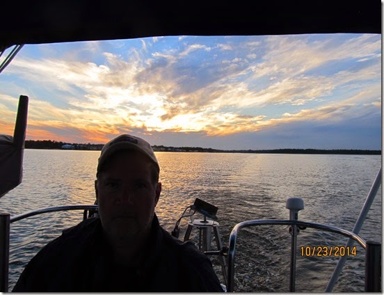
The winds were not letting up and were clocking more to the east.  Horn Island is a long narrow island that is laid out roughly east and west.  I did not think we would find a protected anchorage on Horn Island that night.  On the north side I would be exposed the the ENE wind (which was building) and on the south side of the island I would be exposed to the Gulf swell.  I began looking at a tiny little island called Round Island as a possible anchorage. I turn north to pass Horn Island to the north and headed toward Round Island.  It was another long slog into the wind be as we got closer to the island the wave decreased in size and speed forward increased.  We anchored down in the lee of the island as the sun set and rolled with some residual swell from the gulf.
image
While we were anchored there the winds really howled all thru the night.  The anchor did not drag an inch and Tamera and I got some real confidence in its holding  power.  The anchor is a 45 lb Delta with a chain rode.  It is a great deal better than the CQR anchor we use to have.

The Journey Onward

Again we arose early to continue trekking east and the wind had not abated at all.  Again I chose to go south of the barrier island Petit Bois (pronounced by Texans as Petty Boy and by everybody else as Peteet Bwau) to get some protection.  It worked and again we were able to sail a bit. The winds were strong but the island offered some protection.
image
We noticed and sail boat that was not too far behind us and staying closer to the island.  There was the gap between Petit Bois and Dauphin Island and the swell and waves really made this section particularly rough.  I thought about turning back but it is hard to give back miles you have fought for knowing you are going to have to fight for the again. 
When we made the turn south to head around Petit Bois we put up the sails.  We continued to sail out pass Petit Bois into the Gap.  Once it was getting too rough we pulled in the sail and motored toward the lea side of Dauphin Island.  We looked back for the sailboat behind us and realized they had turned back.  I could not blame them because it got very rough for a while.  I was looking at the sun thru the waves ahead.  That is generally not a good thing. 
The plan was to sail (actually motor because the wind was on the nose out of the ENE) along the south side of Dauphin Island and pass thru the cut at the east end of the island.
image
It turns out that cut is not longer there.  It is completely blocked by land now.  We had not planned on this and had to turn south and go way around.  Because the charts were so incorrect we were leery of the shoals  on the chart south of the island. We went all the way down to the old abandoned lighthouse marking the shoal before turning north into Mobile Bay.
IMG_6203
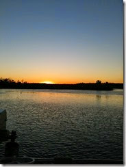
As we got into Mobile bay the winds started to abate and we slipped back into the ICW in calm weather.  We proceeded up the ICW canal to Wolf Lake to anchor.  It was pretty.
IMG_6241
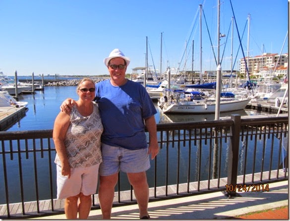
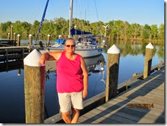
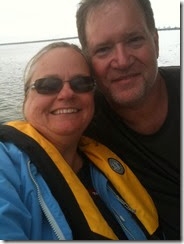
The next day we sailed the 22 miles to Pensacola.  The water was clear and the when the dolphins swam next to the boat you could see them under the water.  We got into the marina Palafox and got some showers.  There we are in the picture below we are cleaned up and fed.  Kooky Dance is in the background.
IMG_6292
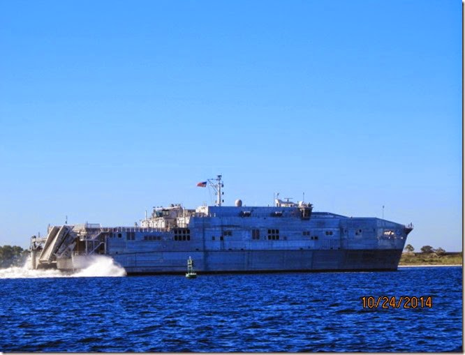
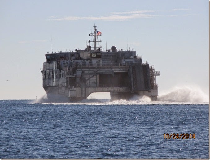
We passed a pretty unique Navy boat in the way into Pensacola Bay.
IMG_6286
IMG_6281

Saturday, October 25, 2014

The First Mate Perspective

The trip so far....
By Tamera the First Mate

I have read a million articles about cruising while waiting for our dream to come true.  Many of the articles were brutally honest and said there will be times when you hate the wind, the water, the sand, the birds, your sailing partners, the pounding into the waves, the noise of everything banging around and you will truly hate pretty much everything around you.....but nobody told me it would happen on the first day !!
Don't I look happy all bundled up with my blanket?

Never fear.....things got a whole lot better.

Ok Scott posted about our rocky start so I won't go into all that but as I write this in our quiet wonderful marina in Pensacola Florida the memories are still fresh.

I feel fortunate to have such a wonderful captain manning this vessel.  We have both had to gain confidence in our skills as we begun this wonderful journey.  I am sure I get on his nerves sometimes asking him:

Are you sure we fit under this bridge????


What is our depth?


Why are we pointing that way, don't we need to be over there?


Are you too close to that boat?


What mile marker we at?
 

AND then I get the LOOK.....so I shut up....for awhile.


I do my part to keep things going:  I make decent meals when I can, I keep the charts in the cockpit and give regular updates on our progress and let the captain know what is ahead.


Things have been pretty wonderful at times, really boring at times... but then we get to see something like this:

An Eagle

Sunrise through the swamps in Louisiana

 
Sunrise on Wolf Bay

Makes it all seem worthwhile and really glad we did not quit the first day !!!

Friday, October 24, 2014

Getting Thru the Big Easy

By Capt. Scott Buckley

Position: 30 08' 42'N, 089 38' 30'W
Progress towards destination: 348.0 nm

Getting Accross

Going by boat to the East or West thru New Orleans is not for the faint of heart.  In fact it is likely to involve some heart pounding moments.  The way the canal is set up is with three locks on to and off of the Mississippi river.  This is necessary because the height of the Mississippi is anywhere from 4 to 8 feet above sea level in the New Orleans area.  You enter a lock and the lock is flooded or drain to match the exiting water level.

How the New Orleans Mississippi Lock Work

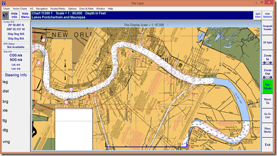
The Intercoastal waterway crosses the Mississippi with a set of 3 locks to manage the mostly barge traffic and water level differences.  There are 2 locks on the west side (coming into the picture below from the bottom) and one lock on the east side of the river (coming into the center top of the picture below).  The 2 locks on the west side are positioned up and down stream of the eastern lock.  The upriver west lock is the Harvey Lock.  The central eastern lock is the Industrial Lock and the downriver lock is the Algiers Lock.  The lock are arranged this way to save a little energy by letting barge traffic take advantage of the river current.  It would be impractical to have the lock directly across the river from one another on such a heavily traveled river and with no means for some of these large cargo vessels to stop for intersecting traffic.   So if there were only 2 locks and they were staggered then and one of the directions of travel would always be and upstream push once on the river. 
image
In the picture above the Mississippi river is running from left to right.  So going to the east the first lock you encounter is the most northern lock called the Harvey lock (in the picture the left most lock).  It actually delivers vessels onto part of the Mississippi that is running north.  Why this is confusing will become apparent later.  Once you are discharged from the Harvey lock you proceed downriver to the Industrial locks. 

Confusing Traffic

As you are discharge onto the river you are to make contact with Gretna Vessel Traffic Services (a function of the USCG) on marine VHF channel 12.  You tell them the name of your boat and type and destination.  VTS will ask your location and what bank you will favor; east or west.  Hear is where the confusion enters into it.  I said to VTS the west bank because I assumed the bank of the Mississippi that touches the western half of the US would be the western bank however in area where the Mississippi run to the north the western bank is actually the eastern bank by the compass.  My first mate pointed out that I told the VTS that I would be on the western bank when in fact I was on the eastern bank.  I started to explain my logic but realized the 1st mate might be right.  I started changing sides of the river (no small task is the river is nearly a half mile wide) while VTS started listing very quickly the major ships and tug traffic you are likely to encounter.  They then instruct you to have another marine VHF radio tuned to channel 67 and to contact these other vessels which I honestly could only remember part of the name of one of them (mumble north 46).  I called and actually mumbled something and then said North 46.  I got and answer and we agreed he would pass me on the two whistle side (more on whistles in another post).  I was busy changing side of the river to the actually eastern side and both radios were chattering away and I think I got call a few times and heard other talking about the small sail boat on the river and my mouth was dry and my heart was pounding and the 1st mate is asking me question and I just want to be anywhere but here.  The radios kept chattering and North 46 (a green ship) and South 85 (a black ship) turned out to be these huge ocean going ships, and they both appeared to be heading directly at me.  Along with all the other chatter I realized my first assumption about west bank and east bank was actually correct except I was mostly across the river to the wrong side when I learned this. I had already agreed to let the giant ship behind me pass me to port and I was in the wrong position for this and that guy was coming up fast.  At the same time I heard South 85 (the giant black ship coming up river) was going to favor the bend.  I was assuming that meant he would stay tight to the inside of the bend and not swing wide.  If I returned to the correct side (assuming I could do so before being run over) and South 85 was favoring the bend then that would push me tight against the bank.  I could probably make it but it would leave little room to maneuver and while that ship is beside me would blind me to the rest of the traffic on the river.  Remember I would still need to cross the river to the east bank to get to the Industrial Locks.  I made the decision right then to continue crossing to the eastern bank for better or worse.  That would keep me out of the way of South 85 and I would just have to work it out with North 46.   At about the same time North 46 calls the south bound sail boat (that’s me) and said he had changed his mind and wanted to pass on the one whistle and for me to just stay over on that side.  I don’t know exactly how but things just started to fall into place.  I still had not cleared up the confusion with VTS and decided not to.  They probably would not notice.  Soon we approached the Industrial locks.

Some background about anxiety

Before I move on to getting through the locks I think I should set the whole thing up for you.  Tamera and I had been dreading this part of the passage east from the moment we left.  We were only able to contain the anxiety because we could convince ourselves it was still days away, but Monday night as we sat anchored in Salvador Lake just 20 miles from the locks our tensions were at new levels.  We reviewed again and again the bridges before and after the lock.  What ones we had to call and what one worked in conjunction with the lock.  Some of the bridges had curfews and would not open during certain times for morning and afternoon rush hours. If any of these bridges did not work and our timing was blown what were our contingency plans. 
I went over what I thought would be some difficult situations and said what we would or would not do.  One was being locked up with other big boats and getting bashed around by there prop wash.  Another was to get stuck on the river waiting for a slot into the lock off of the river. For the prop wash problem I would talk to the lock master on site however if we got stuck on the river for a day I did not know what to do.  I tried to find a number for VTS to get advise from them but could not find one.  In retrospect I doubt they would have been able to help.  The tug and barges usually nose the barges into the bank at the side of the river or tie off to dolphins along the shoreline.  This is not really and option for a sailboat and would likely cause more problems than it solves.

The Quiet Before the Storm

So there we are anchored on Salvador Lake the night before and neither of us is getting much sleep.  We arise at 5:30AM and make ready and get underway.  Neither of us wants to eat with our stomachs all knotted up.  Barge traffic is very heavy and much of the way is a no wake zone so progress is slow and warranted the early start. The first mate was so on edge she could not remember how to tie a bowline knot.  Something she can regularly do without even looking but this morning everything seemed more complicated. 
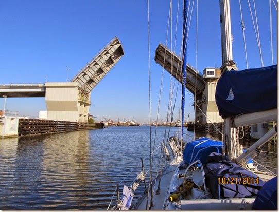
IMG_6051
We start encountering bridges immediately after the morning rush hour curfew and constantly drew closer and closer to he locks.  At 8AM I call the Harvey Lock master and explain the situation.  He said nervousness is good.  It will keep you focused.  He reviewed the procedure and told me what he was going to ask me to do and where to tie up. He said he likes to send sail boats thru by themselves.  He told me when to call him on the VHF channel 14 and how he would then give me instructions. It was very reassuring and I relayed it to the first mate.  He said one thing that at the time did not make sense.  He said: “I don’t mind explaining things.  I want things to go smoothly in my lock.  At least I do, the other guys may do it different”.  I did not make much of it then but later his words returned to me.
IMG_6053
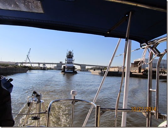
So the canal was crowded.  We had a big tug in front of us and a barge and tow behind.  As instructed we call the Harvey locks when we were between the Palco bridge and the Express bridge.  The Lock Master immediately answered and said he was going to change things up from what he said this morning.  He wanted me to pull up and tie off to a slanted part of the line up walls into the locks.  Understand there is a road bridge and a railroad bridge immediately in front.
IMG_6061
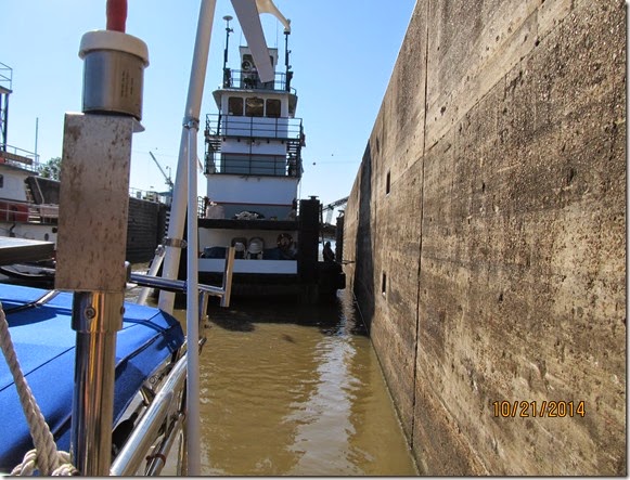
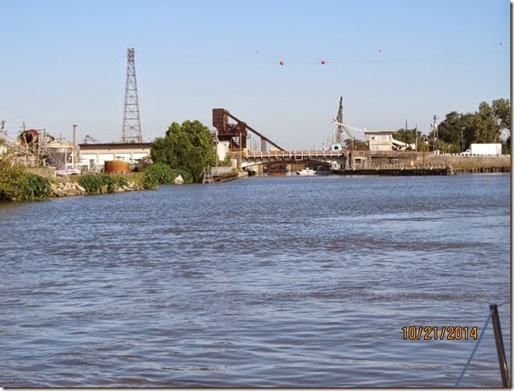
That low dark bulkhead just to the right of the bridges in the picture above is where he want us to tie up an wait.  He had a tug in the lock and wanted the barge that was behind us to tie up to the wall on the left side of the bridge.  He had a large tug wait on the side of the canal.  He was going to put all three of us into the lock together.  Remember one of my dreaded situations.  However the Lock Master instructed us to pull in second after the barge had tied off and pull forward to the second pin.  That way when he opens the lock gates to the river I could be the first to leave and not get hammered by the prop wash of the bigger boats.  I was starting to like this guy.
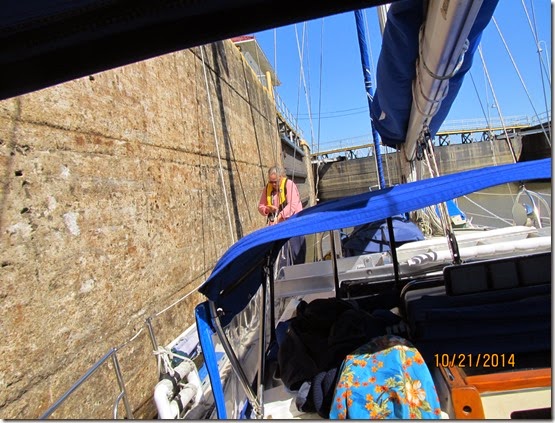
So all three of us were staged up out side the locks.  We did not have to call the lift bridge or the railroad bridge because they worked in conjunction with the lock.  When the Lock master sounded his horn the lift bridge and railroad bridge took that as instruction to open.  It made sense.  The railroad bridge was being worked on so there was some delay as they got the men off of it before they raised it, but raise it they did and out came the tug.  We got a couple of scratches as the tug went by but otherwise did OK and proceeded into the lock after the tug got tied up.
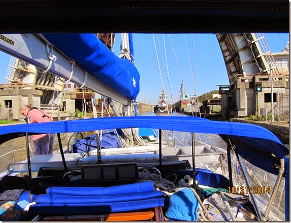
IMG_6062
We got tied up to the correct pin without incident.  The 1st mate was an awesome line handler.
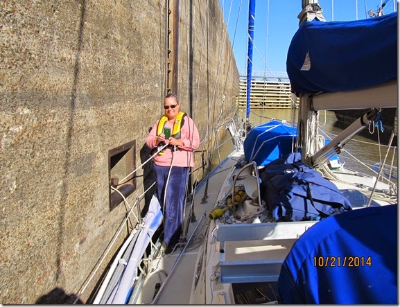
IMG_6065
The last tug was brought in.
IMG_6064
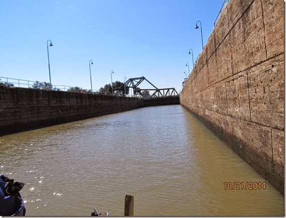
The lock gates were closed and the water level rose about 4 feet.  The lock master told us when he blows the horn that we are to proceed out first.  He warned; “don’t delay”.  When I heard the horn we cast off and left.
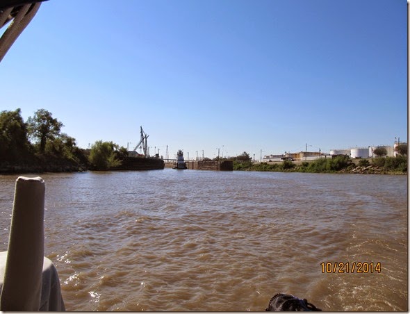
IMG_6071
The above picture is the view of the Harvey lock after we left and proceeded into the river. 
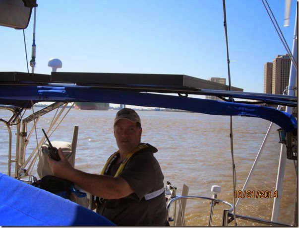
IMG_6086
Remember the previous bit about checking in with the VTS and having to talk with the other vessels.  This is a picture of “tense me” with two radios, steering the boat.  In the background you can see North 46 coming up from behind.  I am looking for someplace to hide or wishing I was anyplace but here.  The 1st mate was feeding information about boats and movements around us the whole time.
IMG_6078 IMG_6088 IMG_6089 IMG_6090
Seeing New Orleans this way is pretty neat.
The short story is working together we made it down river to the Industrial locks and started calling for the Lock Master on the Marine VHF channel 14.  No Answer. 

Nobodies Home.

Turns out that the tug and barge (The Polly P) we were lock with was also waiting on the same lock.  He was pushed into the bank waiting.  He called me on the radio and said the lock does not appear to be answering the radio or telephone.  The 1st mate gave me the lock phone number and I tried to call and was only able to leave a message.  The 1st mate tried the office and they assured her the locks were operating and the Lock Master was perhaps occupied with personal business.  We were instructed to continue trying to reach him on the radio and telephone.  I relayed the message to the Polly P and we both continued calling the lock for the next 30 mins while we drifted around in the river.
Finally the Industrial Lock Master answered the radio calls like nothing is out of the ordinary and when I call him he said for me to come ahead.  The rest of the time he is answering calls from the 29 waiting tugs that have been waiting to get thru the lock.  I say 29 because I overheard him up date the status on tugs turn as 11th, then 6th and also I heard a 29th. 
We proceeded toward the lock and I could see the lock gate was being opened.  No horn was sounded and there was a draw bridge between the me and the lock.  I called the Lock Master again and asked if I need to call the bridge or was that some thing they coordinated like the Harvey Locks.  The reply was; “This ain’t the Harvey, you call em”..  Tamera knew the name (The Claude St bridge) and I called them and asked for them to open.  No answer.  I called again and they said they were closing the traffic barriers now to just cool off.  I was stopped in the channel drifting towards the bridge while we waited for it to get open.  What is amazing is this bridge sits right next to the lock gates and I am stopped in the channel on the other side of the bridge and the lock gate are open and the Lock Master told me to come into the lock and the bridge operator did nothing.  They all monitor the same marine VHF channel 14.
We proceeded into the locks alone and the gates were closed.  In this case we locked off of the river alone.  In this lock there are no pins to tie up to.  The Lock Master will throw you a line to hold onto.  This Lock Master gave no other instructions.  The doors were open and we proceeded out. 
IMG_6095 IMG_6096
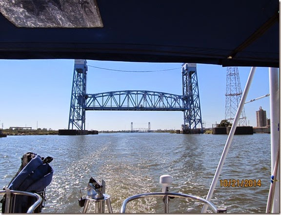
Immediately after getting out of the lock you need to call the Claire borne St. bridge.  It also is not coordinated with the lock even though there is no place to go between the lock and the bridge.   called the bridge and got a garbled response.  I was not even sure it was the bridge that responded.  I waited a bit and watched the bridge for evidence the bridge operator was making ready to open the bridge.  I saw no indication traffic was being stopped and called the Bridge to confirm the request.  I got an angry reply that she was putting down the barriers now, to just keep my britches on. 
At the next bridge (Florida St bridge) I called again.  I was told to stand by.  So we waited and waited and drifted down towards the bridge.  I called again to find out how much longer to stand by so I could move the boat away from the bridge and into a clearer area if it was going to be much longer.  Again I got the angry reply that the barriers are going down now.
IMG_6106
You can see both the Claire borne and Florida (closest one) street bridges in this picture.  There is a striking difference between the west bank locks and the east bank locks.  I have been thru these locks twice.  I have talked to the Algiers and Harvey locks and they have been very helpful and given me the information I needed to get thru the lock successfully.  The adjacent bridges are coordinated with the lock thru horn signals.  You are free to contact them but they are going to remind you they will open by command from the Lock Master.  The east bank lock and there is only one of them and maybe that is the problem does not answer the phone and when he finally does answer gives instructions that short and non-descript.  The bridges are not commanded by the Lock Master and operate begrudgingly to radioed requests.  You may have to suffer some attitude but they do eventually open and let you thru.
We were thru the Big Easy.
IMG_6109
This is the NASA facility on the way out of town that built the shuttles' engines and in the 1960’s built the engines for the Saturn 5 rocket.

Saturday, October 18, 2014

The Logistics of Cruising

The Logistics of Cruising

By Capt. Scott

Position: 29 56' 50'N, 091 58' 59'W

Progress towards destination: 210.0 nm

We are currently docked in Delcambre LA working out the next part of our journey.  We were visited by some friends that we have stayed in touch with when we lived in this part of the US.  Randy and Sandra Boulet took us to dinner in Abbeyville at Shucks.  Dinner was great and the company was something Tamera and I both sorely needed. We had drug along our laundry thinking we could stop by the Laundromat after dinner and continue to visit while Tamera and I washed a few cloths.  Remember the Seagull Guano incidents in the previous post.  Turns out the only Laundromat in Abbeyville was also a local gang hangout and was NOT recommended at night unless heavily armed.  Sandra and Randy offered to do our laundry and bring it to us the next day.  That was so gracious however it made Tamera and I feel terrible.  I mean it could be interpreted as; "Hey Randy and Sandra are taking us to dinner.  Lets get them to wash our clothes too."  That is like the opposite of graciousness. Anyway it was a great night and we look forward to seeing them later today.

I had talked to one friend that said the winds would be from the SW for the next five days and that would be very favorable for an offshore passage from Louisiana to Florida.  The 1st mate and I started getting very excited about a faster passage to Florida.  We started planning and securing things on board. 

We planned to travel from Delcambre to Morgan City LA and tie up at the city dock or proceed thru the Bayou Boeuf  locks and anchor in Wallis Bayou.  The Wallis Bayou option is preferred if heading east on the ICW because of the exposure to river traffic at the Morgan City docks can bounce your boat against the pilings.  It is recommended to have fender boards if you stay at the Morgan City docks. 

We would send the night in Morgan City and head to the Gulf of Mexico by way of the Atchafalaya river.  It would be about 29 miles to the open Gulf with enough depth to turn east.  I thought by the first day we could get to Ship Shoals.  From there (depending on weather we could get most of the way around Main Pass LA (where the Mississippi empties into the Gulf) and make our turn north either behind the Chandelier Islands or north east to Mobile or Passcagoula MS.

Sounds too good to be true.

Thankfully we checked the actual offshore forecast and found the prediction were for east winds of 20 knots with a strong weather system arriving Wednesday or Thursday.  That would be on the nose for 200 miles and a weather system chasing us.  I was pretty sure we could make it but would be beat up and exhausted at the end of it and it carried some unnecessary risks.  We could still travel the ICW through New Orleans and the Mississippi Sound but they can be a challenge as well with virtually few chances to sail.

We had a planned to travel to Shalimar FL via the ICW and meet up with some spare engine parts I had sent there.  As the 1st mate was reading thru the "Skipper Bob's Cruising the Gulf Coast" guide she read a note that sail boats that are not able to pass under a 48' bridge should exist the ICW at Pascagoula MS.  I knew that was well before Shalimar FL which is just east of Destine FL.  I checked the charts to see if I could enter Choctawhatchee Bay for access to Shalimar and saw it was blocked by a 49' fixed bridge at its entrance.  Kooky Dance is 59' high so I started searching for a way into Shalimar and found I would need to go all the way down to Panama City FL and back track 70 miles to Shalimar. 

So why did I pick Shalimar you may ask and I wish I had a clever answer but 2 years ago while making a delivery of a trawler from S. Carolina to Western Louisiana we stopped into Shalimar to wait out some weather.  It was close to everything, had a courtesy car and the folks there were pretty nice.  That trawler was only 24' high.  I had not checked the entire route for bridge height.

To add insult to injury when I checked bridge height for the rest of the way to Apalachicola FL I found another bridge with a fix height of 50' on the east side of Panama City FL.  I had wanted to show the 1st mate some of the most beautiful parts of the ICW on the Gulf Coast.  In particular the section from Panama City to Apalachicola.   I would not be able to with the bridge height limits.  This also meant some additional offshore sections of the passage that were not planned in order to go around them. 

Feeling like and idiot

 I was kicking myself pretty hard for missing these obstacles and planning appropriately.  In fact the amount of crow I will need to eat is not over yet.  I will still need to call the Shalimar marina and tell them that I will not be able to stay at their marina.  While that is probably not the end of the world it was part of the agreement for them to accept parts on my behalf.  I am hoping that they will be understanding and if they aren't I will need to fake a little sympathetic brain damage.  Preferably some sort of brain damage suffered while saving a bunch of puppies or small children.

A Wakeup call.

The 1st mate and I swung into action to work out solutions.  We looked at renting a car and driving to Shalimar to pick up the parts.  But from where?  We looked and timing and option from Orange Beach AL to Panama City FL.  We poured through the Dozier's Waterway Guide, Skipper Bob's guide and Active Captain.  Made some phone calls and made plans to stay in Pensacola FL and drive over to Shalimar to get the parts.  The first mate also worked through some anchoring options from the list of daily progress plans I had made.  Our confidence was rattled and we were feeling that familiar tension that characterized the first couple of days of the voyage.  I was feeling so inept about my ability to do this, but the fact is we are just starting out and we always knew we had a lot to learn, it just staggering the amount of things we don't know.  1st mate wanted to take a walk to unwind a little and I joined her for the benefits as well.

The Difficult part ahead.

We have some challenging miles ahead before we can relax a little and they will be getting thru the Mississippi locks  Both onto and off of the river and all the bridges to contend with and their operational restrictions.  Getting onto the river at the Harvey lock is no guarantee to get off of the river at the Industrial locks.  If there is a wait at the Industrial locks you are stuck waiting on the river with all its traffic, floating debris and current.  I don't even know anyone to call about what options there are if you get stuck on the river for 24 hrs (which I hear is possible).
 The second challenge will be Mississippi Sound.  A long stretch of shallow open water that run east and west. It runs from the Riggolets (pronounced The Rig-o-lees) just east of New Orleans all the way to the east end of Mobile Bay Alabama.  There are only a few places along the way to find refuge from bad weather. 

Courage

On our boat card we put a quote from a movie we like called "Cloud Atlas" .  The quote is: "Our survival demands our courage."  I liked the quote because it says to me that those things worth having are never easy.  While I always understood this adventure would take courage, I don't think I fully appreciated how much it would take.  It is definitely testing our metal and this far as a team we are meeting the challenges.

Thursday, October 16, 2014

The Voyage Begins

The decision to go:

By Captain Scott

As stated in the last post we were waiting for weather and the delivery of some parts.  Well both arrived about mid day and while Tamera and I were running parts over to the UPS office I said we should leave today instead of tomorrow.  We could get a full day jump on the schedule and the weather immediately after a cold front can be agreeable.
Tamera and I discussed it and felt if we could complete everything we needed to by 3PM and we could push off that very day and get to our first destination in Laguna harbor.  Rush we did and we untied the lies at 3:02 PM. 

That first night:

The wind and current were with us and we sped down the Houston ship channel at 8  and 9 knots and turned into the east bound intercoastal waterway at around 6PM to head to Laguna Harbor.  We eventually found it and entered the harbor after sunset. Tamera took a selfie of us sailing down the Houston Ship channel and posted on Facebook that we were officially cruisers.
IMG_2076
Laguna Harbor was surprisingly shallow.  We were unable to get up to the sea wall due to depth and we only draw 5’.  There were a couple of 6’ shoals as we entered the harbor that caused us concern.  We discussed anchoring in the middle of the harbor.  The winds were expected to increase from the north and this generally causes the water level in the area to drop.  If the water level dropped more than a foot we make get stuck inside the harbor and unable to proceed until the water returned.
We discussed other anchorages at the Galveston Yacht Basin and out on the ship anchorages next to the jetties and all had various drawbacks.  Poor holding, no protection from the bad weather.  Then the 1st mate suggested tying off to the break water bulkhead at the Galveston Yacht Basin.  This is sometimes used as a poor man transit dock but it does have a few drawbacks.  Number one is it is the roosting site from almost all the birds in the world and with that feature has acquired a certain fragrant bouquet of smells that is very strong when passing down wind of the breakwater.  Number two is no hookup or services of any kind.  Number three is we had not asked permission to tie up and finally the breakwater is not the greatest protection or tie up option.  This does illustrate how bad things looked that first night.  Tying up to the breakwater seemed like the best alternative to us.
To get to the breakwater we had to back track in the dark to travel though the intersection of the intercoastal waterway, the Houston ship channel the Texas City ship channel, the Bolivar Peninsula ferry route and the Galveston ship channel.  I am quite sure that some memo had gone out to all the ships and barges in the area to proceed to run down any small sailboat they saw in this area on that night.  However on that night there was only one crazy couple stupid enough to leave on the spur of the moment and go sputtering around this shipping shooting gallery.  Yeah, the intrepid crew of the Kooky Dance.  I think we might have been dancing if we had not been so afraid of dying our first day out cruising.
As we approached the breakwater we were by greeted by possibly every bird in the world roosting on the breakwater to take one last dump before flying off to permanently defile some other flat surface that very night.  We got tied up and had to get on the breakwater to handle lines and adjust fenders.  I did so without thinking about putting on some shoes first.  Oh the feeling of seagull guano oozing up between your toes can only be match by the joy of grabbing a piling to find the top sopping wet with yet more seagull gooey excretions.  But the joy does not end there.  Due to the weather we had to tie up on the down wind side of the breakwater so the wind did not slam the boat into the pilings or pin the boat so that morning departure would be dangerous. With no AC we had to open the port holes and in wafted that fragrant bouquet.  Ah living the cruising dream.  Ten years we waited for this.
Well that night the wind really increased and the seas against the breakwater really built.  We knew this because the waves were slamming into the breakwater just a few feet from our heads.  We were up and down all night checking on things, adding lines (which required additional trips bare footed onto the guano slip n slid), and checking on each other to make sure we had not suffered a brain hemorrhage from high blood pressure. I recall one response in particular “ no but I am hopeful”.  I am sure in hind sight the survivor would have called the victim a coward for taking the easy way out. 

The second day

We already had a long day of passage planned to get from Laguna Harbor to Shell Island on the Texas / Louisiana state line and the back tracking over to Galveston made that distance longer by about 3 to 4 miles.  We got up at 6AM and were away from the breakwater by 6:30 and headed out in the dark.  We knew we would have some light by 7AM.  Either another memo had gone out to every vessel in the area to converge on these shipping intersections or the previous memo cover the previous night and the following morning.  Needless to say there were ships and barges and ferries to the port and more of the same to starboard.  The AIS collision alarm was set to go off at it shortest setting and was going off consistently when you passed a vessel in the ship channel. When the alarm sounded it was usually not a surprise and you would be looking a the offending vessel next to you.  Except that morning when it start going off repeatedly when no visible vessels were near.  That turns out to be a great way to get my undivided attention.  Start alarming the AIS that are in the threat of an eminent collision and you don’t see the boat that the AIS is taking about. You clear the alarm and it goes off again.  I am yelling at the darkness, “Where are you?” and my 1st mate thinks I am yelling at her and that I have finally lost my mind on our first day of cruising.  Living the dream.
Like I had said the wind had piped up pretty good so it was a choppy slog across the shipping intersections and into the ICW where we encountered ALOT of barge traffic.  As the sun rose and we had some daylight the winds were favorable for sailing.  We rolled out the genoa and motor sailed the rest of the day.  We really push Kooky Dance and she maintain an average speed of around 8 knots.   We were passing barge traffic regularly.  If you have done this you can relate to how much fun it is to do under sail in very strong windy conditions.  As the heavy barges push thru the narrow channels they create these slip streams along there sides.  The water rushes by them faster than the speed they are traveling.  When you are passing them this slip stream slows you down so passing them takes forever and your room to maneuver is limited. And if there is oncoming traffic you immediately understand that a 53 year old man can want to crap his pants because you know you are going to cause the horrible death of your crew and your boat on your fist day out cruising.
IMG_2085
We went thru High Island, Taylor Outfall Bayou, Port Arthur and finally arrived a Shell Island as the sun set.  I was sure the engine alternator was acting up so I was pouring through the manuals and Tamera made a nice spaghetti dinner.  It was a pretty nice anchorage but to be honest the previous restless night at the guano slip-n-slide and the white knuckled hard driving of the boat all day, meant our appreciation of that first anchorage when something like this. “Oh yeah nice, I going to bed.” This was our second day of cruising.
IMG_2089

The third day

Throughout the night Tamera and I would arise and check the anchor, I would check the batteries and both of us would try to relax.  We arose early and got underway a little before 6:30AM and headed for the Ellender bridge.  We had another long day of sailing and motoring to reach our next anchorage at the Mermentau River.  According to the cruisers guide the Ellender bridge operator requires a 4 hour notice and a box of chocolates in order to get the bridge to open.  Ok I made up the part about the chocolates but really -  a 4 hour notice.  There were also instructions to call the Bayou Black pontoon bridge if you could not reach them by phone.  With only 1 bar showing Tamera was able to call them and they told her call again when she got closer.  So Tamera tried to call again when we were closer (no bars) and I also tried to call the pontoon bridge on the radio but got nothing.  So then I just tried to call the Ellender bridge on VHF channel 14 and surprise surprise it worked. They opened up and we went through.  Much easier then the cruising guide lead us to believe.  We went thru the Calcasieu locks (Tamera’s first) and a couple of pontoon bridges.  We arrived at the Mermentau River anchorage a little after 4PM and I made a refreshing adult beverage for the two of us. Because we had not eaten in a while we got tipsy from one drink and recounted the previous two days events and laughed our butts off.  We laughed about the terror and the misery and how it was going to be a great story.  We had a good night and slept well.  I checked the batteries throughout the night and came to the conclusion that nothing was wrong except my understanding of how all the charging systems would work together.  With the wind and sun and engine all charging the batteries they get charge pretty quickly and go into an float charge mode after a couple of hours.  The batteries hold plenty of charge. There was a lot less to worry about and this was our third day of cruising.
IMG_2102 IMG_2101

The fourth day

Again we arose early and headed to our next destination at Delcambre LA at the marina.  It was a pretty day and we were a lot more relaxed and confident.  We made to the Delcambre marina but found out the water was too shallow however the dock master found us some alternate dockage.  We will meet with some friends in the area and rest up a couple of days here.  Top off the water tanks, take showers, wash the boat, maybe some laundry.
IMG_5840 
It is our fourth day of cruising and things are looking better and I think slowing down a little is exactly what the Doctor ordered.
We still have a long way to go to the Bahamas and I am sure plenty of stories to come.

Monday, October 13, 2014

The Eve of Deprarture AGAIN

Problem Solving

The problems with the depth sounder are fixed and I have to say the NEXUS tech support was pretty helpful.  They were pretty proactive to find solutions that were affordable.  The equipment was 5 years old and 3 years out of warranty. They worked out an exchange where they will credit me when I return the defective parts.  Additionally they are sending a spare depth transducer because they thought the one they sent was the incorrect one.  They said they were sending a 52mm transducer however when I measured the transducer on the boat it measured about 41mm.  In order to swap the transducers I would have to haul the boat out of the water.  They agreed that was an excessive fix and agreed to send another.

Weather

Right now we are waiting out the weather that is to pass thru today Monday (Oct 13, 2014) and will leave tomorrow morning.  It is blowing 25 knots with higher gusts and based on the speed of the front I would expect 50 knot wind during the passage of the front.  Looking out the porthole I see the clouds building to the north and expect the worst storms to hit in about and hour.  The actual front is expect to pass at about 1PM. 
Right now it is sunny and very breezy but I see high clouds to the north bearing down on us at 30 knots.

Waiting on parts

Even though the depth sounder is fixed we are still waiting on parts to show up that it turned out we did not need.  We will need to return them for credit.  The marina store is closed on Mondays and I and the 1st mate are taking watches up at the store.  Cindy the store manager and Bob the harbor master agreed to loan us a key to the store so we could hide inside  when condition worsened.  I got the first watch from 8 to 10AM and it is nearly 10 now so my relief is due shortly. 

Leaving port after a front.

Here on the western Gulf coast there is actually very little tide.  It typically only ranges about 1 ft.  However the water level ranges 4 to 6 feet during the passage of a front due to wind blown tides and barometric pressure.  In this area of the Gulf and in particular in the shallow coastal bays the average water depth is 8 to 10 feet and the lost of 4 feet can stop a sailboat from leaving the slip.  We are hoping that the fact high tide is in the AM and our 5 foot draft will let us sneak out into the ship channel and point south.  Additionally the morning temperature is expected to be in the high 40's has the 1st mate and I looking for some warmer close for the AM departure tomorrow. 
On the plus side the wind should be from a favorable angle for sailing to our first destination at Laguna Point where we will tie up for the night.

Outside Conditions


Friday, October 10, 2014

Events During Departure

Cruising

Position: 29 42' 36N, 094 59' 50W

Progress towards destination: 0.0 nm

How to start a journey to nowhere.

Thursday morning we arose early after having some difficulty sleeping thru the night.  Tamera headed up to the marina store to take a shower and I readied the boat.  I switched on the electronics. I started untying the dock lines and was headed forward to unplug the shore power cord when I heard an alarm going off in the cockpit.  I looked at the instruments expecting it to be the AIS indicating a CPA (closest point of approach) being below the limits.  However it was not the AIS, it was the Nexus MultiController that displayed the depth.  Not having a depth and heading to the east thru the ICW, the Florida Keys and the Bahamas without depth indication.  I began troubleshooting the problem.  We had planned to meet up at the marina store at 7AM for a last cup of coffee with Ms. Cindy.  By a little before 8AM Tamera came back to the boat to find out what the delay was.  I was frantically trying to figure out what the problem was, checking voltages, pouring over the manual and effectively having an anxiety attack.
 
We discussed what was going on and what I had tried and what could be done.  The 1st mate got on the phone to find technicians in the area that might be able to help and the Captain got on the phone to Nexus for technical support.  There was a crowd on the dock that had showed up to see us off and wanted to help in some way.  It was frustrating to be on the phone with tech support, and the local tech and respond to the myriad of question coming from our concerned friends. I had to hold my temper to keep from saying something I would regret.

After lengthy troubleshooting and discussions with Nexus tech support we determined it was likely a problem with the Nexus Server.  This is the device that all the transducers (wind, speed, compass and depth) come into and go out to all the displays and other equipment over the Nexus network or NMEA 183 serial data connections.
 
The local tech showed up around 11AM and we repeated the same troubleshooting exercise.  The entire time my friends were calling me outside to discuss additional possibilities while the tech was calling me below to find the location of parts and to see me demonstrate the troubleshooting result I had already ran.  The tech wanted to pull the transducer out of the hull to inspect it for growth.  It seemed like a long shot but I was going to humor him.  When we inspected the location of the transducer it was obvious that water would gush out of the hole for the period of time until the plug is placed in the hole.  We taped plastic over the sump pump motor and terminal strips and the tech removed the transducer.  An amazing amount of water gushed into the boat.  The kind of gushing that will give you nightmares (trust me on that one).  There was minimal growth on the transducers and the tech agreed with the previous conclusion that the likely culprit was the Nexus server.
 
Nexus had agreed to send an exchanged server for a little over $200 on next day air freight.  I would need to send the bad one back to guarantee the refund.  There was some confusion about the frequency of the transducer so they also sent a replacement transducer at no charge. 
The 1st mate and I discussed this outcome and took into account an approaching cold front Monday and decided to wait and leave Tuesday morning. 
The parts showed up Friday and were installed.  It turned out the transducer that was original to the boat was the correct transducer and once everything was installed it worked like it was supposed to.

In the mean time,

The 1st mate and I are taking care of any last minute items and resting up.  Prior to Thursday morning our mutual pace of work was very intense and we were a little exhausted.

What this actually means.

We are actually cruising.  How many stories have we read about cruiser being delay in areas waiting on parts to ship in.  Our ordeal is not too difficult but it rings of the same problems.  I am happy I was able to troubleshoot the problem and that my conclusion were correct, we are not happy about being delayed but accept that it was the right decision.  We both agreed we did not want to head off without depth instruments.  As a final benefit we scored a spare depth transducer.

Wednesday, October 8, 2014

The Eve of Departure

Last day of work.

By the Captain
The first mate and I had our last day of work on Oct 3,2014.  It was mostly uneventful, but I had a great deal of trouble getting my Give-A-Shit (GAS) meter off of empty.  There was a party however. 

The guys at the marina decided to have a Bon Voyage party for us that Saturday night after we had quit our jobs.  It was a great party.  There was karaoke and a lot of really good singers.   Even the first mate sang a few songs.

The 1st mate got a cake

1st mate sang a song for us.

The run up to departure.

Our original plan was to sail away on Wednesday.  We made lists of the things we had to complete and assigned them to the days they would be done.  Each day things got added to the list.  So many things kept getting added to the list the departure day was moved to Thursday morning.  We sold the cars, emptied the storage unit, stored things on board, tied things down, bought spares, provisioned, fueled up, serviced the winches, changed the engine oil, finalized financials and legal requirements, change of addresses, canceled the mail, canceled the news paper, etc. 
Getting fuel and doing the final pump out.

In addition the 1st mate investigated anchorages, dockage and routes each night.  The first night we will get from Baytown to Laguna Point dock and tie up.  It is free and we like free.  The second night we would like to get as far as Shell Island TX and anchor for the night.  The following night we would like to get as far as the Mermentau River, LA and anchor again. 

We watched the weather and saw there was a front headed our way for Monday night.  Our plan is to get to the Delcambre Yacht Marina Saturday night.  This would give us some slack to be secure before the front arrived.  The transit slip fee is very reasonable here at $35/night.  We will also try to connect with some friends we have in the area.  It would be nice to see them and maybe get a ride to the store.

The OMG moments.

Tamera and I go through these moments of excitement followed by absolute panic.  Moments of thinking about being in the Bahamas and having a great time.  Moments when we realize we have no jobs, no car, no house, no address.  How do you get parts from the internet without an address?  I ordered some spare for the engine and had them sent to a marina that is about 10 days out in our travels.  I had to call the marina and agree to a transit slip at their marina and they would accept the parts on my behalf and I will pick this up there.  How do we get internet as we travel thru the waterways?  How do we navigate the Florida Keys?  What will crossing the Gulf Stream to the Bahamas be like?  I have heard horror stories.  OMG what have we done?

The eve before departure

Tomorrow morning we will awake, have a last cup of coffee at the marina store, say our last good byes and untie the lines and leave to start our new adventure.  Just writing it make my heart flutter and I can admit it all scares the crap out of me.  I hope I have the courage to make this happen.  My 1st mate does not seem as anxious as me.  She may be but is very good at hiding it.

Farewell for now for I don't know when we will have enough time and internet connectivity to post again.  It may not be until Delcambre.